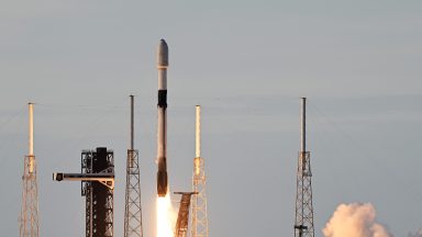
A SpaceX Falcon 9 launched a pair of Maxar Intelligence imaging satellites from Cape Canaveral Space Force Station, Florida, on Aug. 15.
The two Earth-imaging satellites, which lifted off at 9:00 a.m., continue to build out the WorldView Legion constellation for Maxar. SpaceX confirmed the deployment of one of the satellites roughly 50 minutes after launch.
The launch—SpaceX’s 79th of 2024—is the second of three launches needed to deliver the company’s constellation of six WorldView Legion high-resolution imaging satellites. A Falcon 9 launched the first two on May 2 from Vandenberg Space Force Base, California. The first images from those satellites were released last month, providing coverage of the most populated regions.
Liftoff of @Maxar 2! pic.twitter.com/FYnti1LmH7
— SpaceX (@SpaceX) August 15, 2024
“When all six WorldView Legion satellites are launched, it will triple Maxar Intelligence’s capacity to collect 30-centimeter-class [12 inches] and multispectral imagery,” Maxar representatives wrote in a description of the network.
“The full Maxar constellation of 10 electro-optical satellites will image the most rapidly changing areas on Earth as frequently as every 20 to 30 minutes, from sunup to sundown,” they added.
Deployment of @Maxar’s third WorldView Legion satellite confirmed pic.twitter.com/LLx9egqf1z
— SpaceX (@SpaceX) August 15, 2024
The WorldView Legion constellation will eventually consist of electro-optical imaging satellites with a resolution of 30 centimeters, used to collect imagery and map the planet. Maxar Intelligence is the U.S. government’s primary provider of commercial electro-optical imagery. In 2022, the company won a $3.2 billion contract from the National Reconnaissance Office to supply imagery and mapping services over a decade.
Recently, a SpaceX Falcon 9 rocket lifted off from California’s Vandenberg Space Force Base on Sunday night, Aug. 11, sending two satellites into orbit that will provide broadband coverage in the Arctic region.
The two spacecraft of the Arctic Satellite Broadband Mission (ASBM) “are designed to expand broadband coverage to the Arctic region for the U.S. Space Force and Space Norway,” according to aerospace giant Northrop Grumman, which built the mission’s two satellites.
The ASBM satellites — which will operate in a highly elliptical orbit to reach their coverage area — carry multiple instruments, “including military payloads for the U.S. and Norwegian Armed Forces, as well as a commercial payload for Viasat, and a radiation monitor for the European Commission,” Northrop Grumman wrote in its mission description.